

Iceland Highlands Photography Guide: Locations, F-Roads & Photo Tips

Updated: Jul 7

We all long for it in some way — to become explorers, even if only for a moment, and to feel as if we have just found a new planet. When I visited Iceland for the first time many years ago, that is exactly how I felt. After years of returning to Iceland, that feeling changed a little. Many of the classic locations became busier, large parking lots appeared, fences were added, and the feeling of discovery slowly faded away — even though these famous places are still just as beautiful as before.
But the Iceland Highlands still offer that feeling of exploration today. For me, even more strongly than the South Coast did years ago. This is a wild region of endless black volcanic deserts, colorful mountains, dramatic craters, bright green moss, remote lakes and glacial rivers. Most tourists never reach these places because there is no normal paved road leading to them. Visiting the Highlands requires more effort, better planning, the right conditions and a proper 4x4 vehicle. But it is absolutely worth it.
I have been visiting the Iceland Highlands for years, and the feeling of discovery has never disappeared. Quite the opposite — it becomes stronger every time. When you drive through this part of Iceland, there are moments when every 15 minutes feels like landing on a different planet. No crowds, no huge parking lots, no easy roadside viewpoints. Just raw landscapes, silence and scenes that feel almost unreal.
That is why we started including the Highlands in our annual signature Iceland Photo Tour. In this guide, I will show you why this region is such a special place for landscape photography, when and how to visit it, which locations are worth exploring, what kind of car you need, and what you should bring before heading into one of the wildest parts of Iceland.

Iceland Highlands Photography Guide Overview
Use this quick overview to jump directly to the part of the guide you need most:
You can also find more practical Iceland articles in our Iceland Photography Guides.
Best Time to Photograph the Iceland Highlands
Because the Iceland Highlands are so remote, you cannot visit them at any time of year. Most of the roads leading into the Highlands are F-roads — rough mountain roads that are closed for a large part of the year and usually start opening gradually from mid-June.
In recent years, most of the main Highland roads have usually been open by mid-July, but this always depends on the weather. Snow has to melt, river levels need to be manageable, and some roads have to be repaired after winter before they officially open. Before every trip, you should check the current road conditions on the official Icelandic road website.
In general, the best time to visit the Iceland Highlands is from late June to the second half of September. For photography, however, the choice is more interesting. Summer gives you endless light, long sunsets and easier access. September brings darker nights, fewer tourists, stronger colors and a real chance to photograph the Northern Lights.
Summer in the Iceland Highlands
Summer in the Iceland Highlands usually starts in early July and continues until the end of August. This is the season of extremely long days, and around late June and early July you can experience the famous midnight sun period. On the Icelandic mainland, the sun may briefly dip below the horizon, but the night remains bright and the whole evening can feel like one long sunset.
For landscape photographers, this is an incredible time of year. Imagine a sunset that lasts two or three hours. This is exactly the kind of light that makes the Highlands so special — soft, endless and constantly changing across volcanic deserts, colorful mountains, mossy slopes and glacial rivers.
Of course, summer also has its challenges. You will not sleep much if you want to photograph the best light. If you plan to camp, an eye mask is essential. Your sleeping rhythm may turn completely upside down, because the most interesting light often happens very late at night or extremely early in the morning. But for landscape photographers, this is part of the game. We are used to chasing light when most people are sleeping.
The Iceland Highlands are also known for their bright green moss, which covers volcanic mountains, craters and lava fields. Just after the snow melts in June and early July, the moss may not be at its strongest yet, although the landscape is still beautiful. Later in summer, the green tones usually become richer and create a stunning contrast with the black volcanic deserts and colorful rhyolite mountains.

Summer is also a strong season for drone photography in the Highlands. In the middle of summer, glacial rivers are often less flooded, which can make them more photogenic from above. When the rivers carry too much water, the smaller channels can merge together and the patterns may lose some of their shape. With lower water levels, braided glacial rivers often create beautiful abstract lines, textures and colors.
Lower water levels can also make some river crossings easier by car, which gives you a better chance of reaching the locations you planned to visit. This does not mean river crossings should ever be taken lightly, but mid-summer conditions can sometimes be more manageable than later in the season after heavy rain or stronger glacial melt. Summer is the busiest time of year in Iceland, and this is also true for some Highland locations. But even then, the Highlands feel completely different from the South Coast. Compared to Iceland’s classic tourist route, they remain quieter, wilder and much more remote. If you are still deciding when to visit Iceland in general, you can also read our full Guide on the Best Time to Visit Iceland for Photography.
September in the Iceland Highlands
September is another excellent month for photographing the Iceland Highlands. This is when the balance between day and night starts to return to normal. The days become shorter, the nights become longer, and the number of tourists begins to drop.
For photographers, this means more comfortable sunrise and sunset times. You no longer need to stay awake through the entire night to photograph the best light. The light becomes softer, the weather often feels more dramatic, and the landscape starts to take on a deeper autumn mood.
But September offers something even more special: real darkness returns to Iceland. And with darkness comes the chance to photograph the Northern Lights. Imagine standing somewhere deep in the Iceland Highlands, surrounded by volcanic mountains, black deserts and glacial rivers, while the aurora moves above the landscape. This is one of the most powerful experiences you can have as a landscape photographer in Iceland. It is also one of the main reasons why we run our Iceland Photo Tour in September.

For us, September offers the best balance. The Highlands can still be accessible, the landscapes are more colorful, the crowds are smaller, and the nights are dark enough for Northern Lights photography. It gives us a chance not only to experience the feeling of exploration, but also to return home with images that are far less common than the classic views from Iceland’s main tourist routes.
There are some challenges too. In September, rivers can carry more water, which may make some crossings more difficult. With an experienced driver and a properly prepared 4x4 vehicle, this is usually manageable, but conditions should always be respected. The Highlands are remote, and river crossings should never be treated as routine.
More water also has a positive side. The famous green Icelandic moss is often much more vibrant in September than it is in early summer. The landscape feels richer, deeper and more alive. Combined with dramatic weather, softer light and the possibility of Northern Lights, September can be one of the most exciting months to photograph the Iceland Highlands.
Best Photography Locations in the Iceland Highlands
The Iceland Highlands are full of incredible photography locations — from volcanic craters and moss-covered mountains to braided glacial rivers, waterfalls, colorful rhyolite landscapes and vast black deserts. Of course, it would be impossible to include every beautiful place in one article, but I have selected 8 locations that are absolutely worth visiting if you want to experience the real photographic potential of the Iceland Highlands.
1. Háifoss
Háifoss is one of the first places where the landscape starts to feel like a gateway into the Iceland Highlands. Located in South Iceland, close to the road leading toward the Highlands, this 122-meter waterfall drops into the Fossá river canyon and feels much wilder than many of the classic stops along the Ring Road.

For landscape photographers, Háifoss is one of the best waterfall photography locations near the Iceland Highlands because it offers both dramatic upper viewpoints and a more immersive lower canyon perspective. The waterfall lies roughly 90 kilometers north of Iceland’s main Ring Road, and the final 10 kilometers are on a rough F-road. I often think of this section as a small “trailer” for the real F-roads — rocky, slower and much more remote than a normal paved road. A 4x4 vehicle with higher clearance is strongly recommended.
Most visitors photograph Háifoss from the upper viewpoint, but you can also hike down toward the Fossá river and photograph the waterfall from below. From the parking area, the walk to the lower part of the canyon is about 1.8 kilometers one way, with roughly 150 meters of elevation loss — which you have to climb back up on the way out.
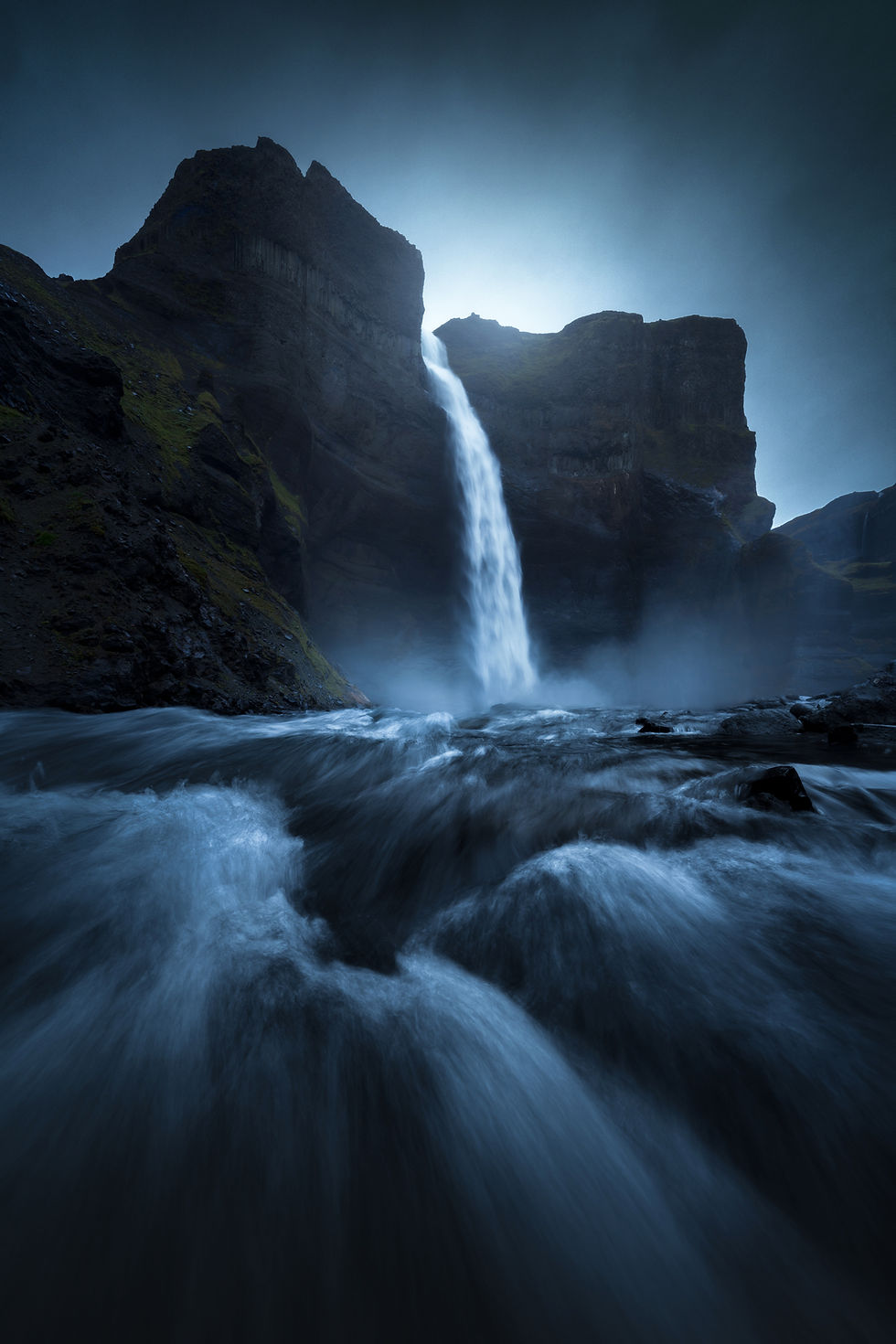
The best time to photograph Háifoss is usually sunset, when the sun can move into a beautiful backlit position above the waterfall. But this place also works very well in rain, low clouds and moody conditions, when the canyon becomes even more dramatic.
GPS Coordinates: N 64°12.41718', W 19°40.98807'
2. Sigöldugljúfur Canyon
Sigöldugljúfur is one of the most beautiful canyon photography locations in the Iceland Highlands, yet it still feels much quieter than many famous places on the South Coast. The name is often translated as the “Valley of Tears,” and once you see the waterfalls flowing one after another into the turquoise canyon below, the name makes sense.

For photographers, Sigöldugljúfur is all about contrast — dark volcanic cliffs, green moss, blue water and small waterfalls falling from the canyon walls. It is not the biggest canyon in Iceland, but it has a special atmosphere and works very well for more intimate landscape photography, details, layers and waterfall compositions.
Access is relatively simple compared to many other Highland locations. Most of the drive follows paved Route 26, and only the final section is on F-208. After about 8 kilometers on the unpaved road, you turn left toward the canyon. This last part can still be rough, rocky and muddy after rain, so a 4x4 vehicle is recommended.
Sunset is usually the best time to photograph Sigöldugljúfur, but it can also work beautifully during the day, especially in cloudy or overcast weather. Soft light helps control the contrast between the bright waterfalls, dark cliffs and colorful water. Park only where it is safe and where the ground is already suitable for vehicles — the Highland landscape is fragile and should never be treated as open terrain for off-road driving.
GPS Coordinates: N 64°9.43908', W 19°7.30558'
3. Hnausapollur and Ljótipollur Crater Lakes
Hnausapollur is one of the most photogenic volcanic crater lakes in the southern Iceland Highlands. It is known for its deep blue water, dark volcanic slopes and the green mountain Tjörvafell rising behind the lake. From a photography perspective, this location works both from the ground and from the air, but the strongest compositions usually come from a higher viewpoint.

One of the best options is to climb the nearby hill called Hnausar. The hike gains roughly 130 meters of elevation and gives you a much better view over the crater lake, Tjörvafell and the surrounding Highland landscape. A drone also works very well here, especially when the blue water, green slopes and black volcanic terrain start to form natural patterns from above.
Hnausapollur is best visited from early summer to early autumn, when the Highland roads are open. In winter, this area is usually very difficult or almost impossible to reach, even with larger 4x4 vehicles. For light, evening golden hour is a great choice if you want Tjörvafell illuminated. If you prefer backlight, early morning can also work, because the main view is oriented toward the southeast.
GPS Coordinates: N 64°3.37860', W 19°1.82298'
A few hundred meters before Hnausapollur, you can also find smaller red volcanic craters. They are not very strong from the ground, but they can look excellent from a drone. The area is quite open, which makes it a good place even for less experienced drone pilots, although you should always check the wind before launching.

Not far from Hnausapollur lies Ljótipollur, another beautiful crater lake in the volcanic Veiðavötn area. Its name is often translated as “Ugly Puddle,” which feels almost funny once you see it in real life. The lake is only about 5 kilometers from Hnausapollur, but you still need a proper 4x4 vehicle to reach it. From the crater rim, the lake can look a little flat with a normal camera. From the air, however, the crater shape, blue water, mossy slopes and volcanic surroundings come together beautifully, making Ljótipollur one of the strongest drone photography locations in this part of the Iceland Highlands.

GPS Coordinates: N 64°2.08682', W 19°0.82708'
4. Landmannalaugar
Landmannalaugar is one of the most famous mountain areas in the Iceland Highlands, and for good reason. The region is known for colorful rhyolite mountains, geothermal valleys, black lava fields, hot springs and landscapes that feel almost unreal. It is one of those places where the “another planet” feeling is not just a phrase.

For landscape photographers, Landmannalaugar is one of the strongest locations in the Highlands, but it is not a place where you simply step out of the car and immediately get the best composition. To really experience it, you need to walk a little. The good news is that many of the best viewpoints do not require technical hiking or huge elevation gain. For anyone with average fitness, exploring the trails around Landmannalaugar is very manageable.
The strength of this location is the variety. In a relatively small area, you can photograph bright rhyolite slopes, dark volcanic lava, green moss, steaming geothermal zones and wide mountain views. The compositions often become much stronger once you gain a little height, because the shapes and color layers of the mountains are much easier to see from above.
Landmannalaugar is also famous for its natural hot springs. In the past, these pools were used by people crossing the interior of Iceland between the south and the north, which is where the name comes from — often translated as “the People’s Pools.” There are campsites and mountain huts nearby, so photographers can stay longer and have a better chance of catching changing weather, better light and quieter moments in one of the most iconic photography locations in the Iceland Highlands.
GPS Coordinates: N 63°58.71105', W 19°5.30198'
5. Laugavegur Trail
The Laugavegur Trail is the most famous hiking route in the Iceland Highlands and one of the best ways to experience this wild landscape on foot. It connects Landmannalaugar with Þórsmörk and passes through some of the most diverse scenery in Iceland — colorful rhyolite mountains, geothermal valleys, black lava fields, volcanic deserts, glacial rivers, mossy valleys and dramatic mountain views.
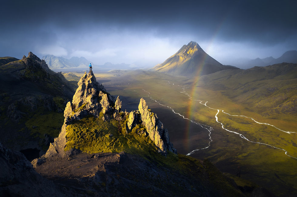
For landscape photographers, Laugavegur is especially interesting because the scenery changes constantly. Around Landmannalaugar, you can photograph steaming geothermal slopes, bright mountain colors and dark lava fields. Later on the trail, the landscape becomes more remote, with black sand, green moss, river valleys, distant glaciers and wide open views that feel completely different from the classic places along Iceland’s South Coast.
This is not a casual short walk. Laugavegur is a multi-day mountain route through remote terrain, where weather can change quickly and conditions can become difficult even in summer. If you plan to hike it with camera gear, be prepared for rain, wind, cold temperatures, river crossings and long days on foot. A lightweight but reliable camera setup is usually much better than carrying too much equipment and losing energy before the best light arrives.

6. Mælifell Mountain
Mælifell is one of the most iconic mountains in the Iceland Highlands. For centuries, it served as a natural landmark for people crossing the interior of Iceland between the south and the north. Its name is often translated as “Measuring Hill,” which makes sense when you see how clearly it rises from the surrounding volcanic desert.

In reality, Mælifell is an old volcano, and in summer it becomes one of the most striking photography locations in the Highlands. Its bright green slopes stand in powerful contrast to the black volcanic sand around it, while glacial rivers cut through the empty landscape nearby. This combination of green, black and silver water patterns is what makes the place feel almost unreal.
For photographers, Mælifell is strongest from the air. From the ground, the mountain is impressive, but a drone reveals its full shape, the scale of the black desert and the patterns of the glacial rivers around it. If you are looking for drone photography locations in the Iceland Highlands, Mælifell is one of the best places you can visit.
Getting there is part of the adventure. There is no paved road leading to Mælifell, which is also why you will not find the same crowds here as in more accessible parts of Iceland. From the south, one possible route starts near Hvolsvöllur, where you turn onto Road 261 and continue onto the mountain road F-210.
Because this is an F-road route, a proper 4x4 vehicle is necessary. The road can be rough, rocky and slow, and after rain you may need to cross smaller rivers. I recommend visiting Mælifell with a larger 4x4 vehicle with good ground clearance. In more challenging conditions, a snorkel can be very useful.
GPS Coordinates: N 63°47.73535', W 18°56.19062'
7. Kerlingarfjöll
Kerlingarfjöll is one of the most unique geothermal mountain areas in the Iceland Highlands. During summer, it is relatively popular with hikers and photographers, but it still feels much wilder than the classic locations along the South Coast. The area is known for brown and orange mountains, steaming geothermal valleys, hot rivers and narrow ridges that create endless possibilities for more intimate landscape photography.

For photographers, Kerlingarfjöll is different from many other Highland locations. It is not only about wide views and dramatic skies. The real strength of this place is in the details — small ridges, layers of colorful earth, steam rising between the hills and hot streams cutting through the geothermal landscape. Around the Hveradalir geothermal area, you can spend hours searching for smaller compositions without needing a huge sky or perfect sunset.
Access is via the F-35 road, which starts not far from Gullfoss. Because this is an F-road, you need a proper 4x4 vehicle with good ground clearance. The drive is not the most difficult in the Iceland Highlands, but it is still a rough mountain road and conditions can change quickly.
The first interesting viewpoints are only a short walk from the parking area, but if you want stronger compositions, it is worth exploring deeper into the geothermal valley. Some steeper sections have stairs, and wooden bridges help you cross the hot streams. Kerlingarfjöll can work well at almost any time of day, because many of the best photographs here include very little sky, or no sky at all. Soft overcast conditions are often perfect for photographing the textures, colors and strange shapes of this geothermal landscape.
GPS Coordinates: N 64°38.72078', W 19°16.94383'
8. Aldeyjarfoss Waterfall
Aldeyjarfoss is one of the most beautiful waterfalls on the northern edge of the Iceland Highlands. Because of its more remote location, it is visited by far fewer people than the famous waterfalls along the South Coast, which helps it keep a wilder and more authentic feeling.

The waterfall is just over 20 meters high and drops into a wide oval pool surrounded by dark basalt columns. This combination of powerful water, volcanic rock and clean geometric shapes makes Aldeyjarfoss a very strong location for landscape photography. It is especially interesting if you like working with contrast — white water, black basalt, blue tones in the river and the raw Highland landscape around it.
To reach Aldeyjarfoss, you need to drive into the northern interior of Iceland. Between Akureyri and Lake Mývatn, turn off the main route toward Road 842 and continue for roughly 40 kilometers through a much quieter part of the country. Since the final approach is on a rough gravel road, I recommend using at least a smaller 4x4 vehicle with good clearance, such as a Dacia Duster or something similar.
For photography, Aldeyjarfoss works well in soft light, cloudy weather or moody conditions. You do not always need a dramatic sunset here, because the strength of the location is in the shape of the waterfall, the basalt formations and the atmosphere of the canyon. It is one of those places where the scene feels simple, powerful and timeless.
GPS Coordinates: N 65°21.95605', W 17°20.34257'
To make planning easier, we created a map with all photography locations mentioned in this Iceland Highlands guide. The map includes 10 spots in total, because some locations in the article are grouped together under one section, such as Hnausapollur and Ljótipollur crater lakes.
How to Get to the Iceland Highlands
When people hear the words “Iceland Highlands,” they often imagine long multi-day hikes with a heavy backpack. And yes, some of the most beautiful trekking routes in Iceland cross this region, including the famous Laugavegur Trail, which we mentioned earlier. But the good news is that many incredible Highland locations can also be reached by car.
This makes the Iceland Highlands much more accessible, even for photographers who do not want to spend several days hiking. The important part is choosing the right vehicle. You cannot drive into the Highlands with just any car. Most of the roads leading into this part of Iceland are F-roads — rough mountain roads with rocks, mud, gravel, steep sections and, in some areas, river crossings. Some of them are manageable in a smaller 4x4, while others require a much more serious vehicle. So how do you choose the right 4x4 car for photographing the Iceland Highlands?
Choosing the Right 4x4 Car
Choosing the right 4x4 vehicle is one of the most important decisions when planning a self-drive trip into the Iceland Highlands. For some locations, a smaller 4x4 such as a Dacia Duster can be enough in good conditions. With this type of car, you can usually reach places like Háifoss, Sigöldugljúfur Canyon, Hnausapollur, Ljótipollur, Aldeyjarfoss and, depending on road conditions, also parts of Kerlingarfjöll and Landmannalaugar.
For more remote Highland routes, however, a small 4x4 may not be enough. If you want to drive roads such as F-261 or F-210, explore areas connected with the Laugavegur Trail, or reach places like Mælifell Mountain, I strongly recommend using a larger and properly prepared 4x4 vehicle. A Toyota Land Cruiser with at least 33-inch tires and a snorkel is a much safer choice for these routes.

The reason is simple: some Highland roads include several river crossings. In normal conditions, some of them may look manageable, but after rain or warmer weather, the rivers can rise quickly and become dangerous, especially for inexperienced drivers. In the Iceland Highlands, the car is not just transport — it is part of your safety plan.
So where can you find a suitable vehicle? Over the years, we have tried several rental companies and local providers in Iceland. For a self-drive photography trip into the Iceland Highlands, one of the best options we have used is Blue Car Rental. In our experience, they offer suitable 4x4 vehicles for Highland travel, clear rental conditions, insurance options and a smooth process without unnecessary complications. This is not meant as an advertisement — it is simply a practical recommendation based on years of traveling through the Iceland Highlands. Always check the current rental terms, insurance details and F-road permissions before booking your car.
Driving F-Roads and River Crossings in the Iceland Highlands
Driving the F-roads is part of what makes photographing the Iceland Highlands so unforgettable. These remote mountain roads take you into some of the wildest landscapes in Iceland — past black lava fields, glacial rivers, colorful mountains, volcanic deserts and places that feel completely removed from the rest of the country. For landscape photographers, F-roads open the door to locations you simply cannot reach from the main Ring Road.
At the same time, F-roads are not normal roads. Conditions can change quickly, river crossings can become dangerous after rain or warm weather, and many routes require a proper 4x4 vehicle, patience and good judgment. If you are planning to photograph the Iceland Highlands on your own, understanding how F-roads and river crossings work is just as important as choosing the right camera gear.

How to Safely Cross Rivers in the Iceland Highlands
River crossings are probably the biggest fear for many photographers and travelers heading into the Iceland Highlands. You have probably seen photos or videos online of flooded rental cars and rescue teams pulling tourists out of rivers. These things do happen, but most of the time they come from one simple problem: people do not understand what they are doing.
The cars we most often see stuck or flooded in Icelandic rivers are small SUVs. Many tourists rent a 4x4 vehicle such as a Dacia Duster or Suzuki Vitara and believe they can cross any river in the Highlands. That is not true. A small 4x4 can be useful on rough gravel roads, but it is not the same as a properly prepared Highland vehicle.
The biggest problem is the air intake. Many smaller 4x4 cars do not have a snorkel and take air through the front of the car. Once the water reaches the air intake, the engine can suck in water instead of air — and the car may stop in the middle of the river. That is exactly the situation you want to avoid.
If you are driving in the Highlands with a car without a snorkel, always stop before a river crossing and check the depth first. If you are not sure, do not cross. One simple trick is to wait a few minutes by the road. Very often, another vehicle will arrive, and you can observe where it crosses, how deep the river is and whether the crossing looks safe.

Another common mistake is driving through rivers too fast. I understand why it happens. If it is your first river crossing, it feels stressful, and the natural reaction is to speed up and “just get through it.” But this is the wrong approach. The faster you drive, the more water you push in front of the car, and the higher the chance that water reaches the engine intake.
When crossing a river, use 4x4 mode or low gear if your vehicle allows it, and drive slowly but steadily. Do not stop in the middle of the river. Do not make sudden moves. Keep the car moving with calm, consistent speed.
Some rivers can be challenging even for larger modified 4x4 vehicles with a snorkel and bigger tires. When rivers are flooded, they can look intimidating for a reason. Even if you have a strong vehicle, do not take unnecessary risks. If possible, wait until a more experienced driver crosses first and watch the line they take.
If nobody comes and you still consider crossing, read the river carefully. Very calm water can often mean the river is deeper. Places where you can see rocks just below the surface are sometimes shallower and more suitable for crossing. If the river flows strongly, it is usually better to cross slightly downstream with the current, not directly against it and not perfectly sideways. This reduces the pressure of the current pushing against the side of the vehicle.
And the most important rule is simple: if you are not sure, turn around. No photo location in the Iceland Highlands is worth losing a car, destroying your trip or putting yourself in danger.
Why You Should Never Drive Off-Road in Iceland
When driving through the Iceland Highlands, it can sometimes be tempting to leave the marked road and explore a new place off-road. Never do this.
At first glance, the ground may look like simple black volcanic dust that will recover after the next rain. But it does not work that way. If you leave tire tracks in the soft volcanic soil, they can remain visible for decades. Now imagine if every visitor drove wherever they wanted. After a few months, many of these wild landscapes would be completely destroyed.
The same applies to Icelandic moss. It may look strong from a distance, but it is extremely fragile. If you drive over it, the damage can last for many years, and in some places it may never fully recover.
Remember that you are a visitor in Iceland. You came to photograph and admire one of the most unique landscapes on Earth, not to leave scars in it. Stay on marked roads, park only where it is allowed and safe, and treat the Highlands with respect. The goal is simple: leave the landscape exactly as you found it, so the next generation of photographers can experience the same feeling of discovery.
Recommended Camera Gear for the Iceland Highlands
The Iceland Highlands are full of photogenic locations, but to get the most out of them, you need camera gear that can handle rough weather, wind, rain, dust and long days in the field. You do not need the most expensive setup in the world, but you should bring equipment that is reliable, flexible and ready for changing conditions.
Below is the camera gear I recommend for photographing the Iceland Highlands.
Camera Body
If you are a photographer, you will probably never forget your camera body. The more important question is what kind of camera body is suitable for the Iceland Highlands.
For me, this is not mainly about megapixels or special features. Those things are nice, but they are not the most important part. What matters much more is battery life, reliability and how well your camera can handle rain, wind and difficult weather conditions.
If you travel into the Iceland Highlands, there is a good chance you will not be there for just one short stop. You may spend a night in a campsite, for example near Landmannalaugar, and many Highland camps do not offer an easy way to charge camera batteries. And believe me, when you drive through the Highlands, you will want to stop and photograph all the time. Your battery will drain faster than you expect.

Weather sealing is also important. Icelandic weather can be wild, and this is especially true in the Highlands. Conditions can change many times in one day, and in autumn it is completely normal to have rain showers again and again. At some point, your camera will probably be outside in the rain. Make sure your camera body has at least some level of weather resistance and always keep it as protected as possible when conditions get rough.
During our Iceland Photo Tour, we have photographed in many different conditions, and so far none of our clients have had serious problems with their cameras. Modern cameras are usually tougher than people think. Still, the Highlands are not a place where I would rely on luck alone.
Recommended Lenses for Highlands Photography
Lenses are just as important as the camera body. If possible, bring lenses that are at least partially weather sealed. Your camera setup is only as strong as its weakest part, and very often that weak part can be a lens that does not handle moisture well.
If you photograph in rain or wet conditions, keep lens cloths or tissues in the car so you can dry your lens after every session. In the Iceland Highlands, you will deal not only with rain, but also with wind, dust and fine volcanic sand. The less you expose your gear to these elements, the better.
The Iceland Highlands are incredibly diverse, so you can use a wide range of focal lengths — from around 12 mm to 400 mm full-frame equivalent. The focal lengths we use most often in the Highlands are around 16 mm, 35 mm, 70 mm and 300 mm.
One advantage of photographing many Highland locations is that you are often relatively close to the car. This means you do not always need to carry every lens in your backpack at the same time, unless you are doing a multi-day hike such as the Laugavegur Trail.
From experience, I recommend bringing two or three good zoom lenses instead of many prime lenses. The reason is simple: the less often you change lenses, the less dust, moisture and volcanic sand gets inside your camera. This is especially important in the Highlands, where the weather can change quickly and the ground is often dry, dusty or windy.
For most Iceland Highlands photography trips, our basic lens setup is:
A wide-angle zoom, such as 12–24 mm, 14–24 mm or 16–35 mm
A standard zoom, such as 24–70 mm
A telephoto lens, such as 70–200 mm or 100–400 mm
With this setup, you can cover almost everything — wide volcanic landscapes, colorful mountains, intimate details, distant ridges, waterfalls, glacial rivers and compressed telephoto scenes. It also keeps your gear simple enough so you are ready when the light suddenly appears and disappears again within minutes.
Tripod and Accessories
The Iceland Highlands are not only rainy. They can also be very windy. A strong and stable tripod is useful, especially if you plan to photograph during blue hour, in low light, or at night.
During the day, modern cameras with good stabilization can handle many situations without a tripod. But if you visit the Highlands in September, I would definitely bring one. You may need it for blue hour, long exposures, or even Northern Lights photography if the sky becomes clear above one of the Highland locations.
Besides a tripod, bring enough lens cloths. You will use them more often than you think. Rain, spray, dust and condensation are all common in the Highlands, and keeping your front element clean can make a big difference.

You should also bring enough spare batteries, especially if you plan to spend full days away from regular charging options. A power bank is very useful, and I also recommend having a 12V car charger or car plug adapter so you can charge your phone, camera batteries or drone batteries while driving between locations.
For the Iceland Highlands, I would keep the gear simple but reliable: a weather-resistant camera, two or three versatile zoom lenses, a strong tripod, enough batteries, cleaning cloths and a way to charge your equipment in the car. That is usually more useful than carrying too much gear and fighting with it in wind, rain and dust.
Drone Photography and Regulations in the Iceland Highlands
One of the most common questions we get about the Iceland Highlands is whether you can fly a drone there. The good news is that in many places, yes, you can. And honestly, the Iceland Highlands are one of the most incredible regions in Iceland for aerial landscape photography.
From above, the landscape suddenly makes even more sense. Glacial rivers become abstract patterns, crater lakes reveal their true shape, black volcanic deserts stretch endlessly in every direction, and green mossy mountains start to look almost unreal. Some places in the Highlands are beautiful from the ground, but from a drone they become completely different.

Of course, drone flying in Iceland is regulated, and you should always check the rules before launching. The regulations are not there to make photography impossible. Their main purpose is to protect nature, wildlife, people and sensitive places where too many drones could quickly become a problem. So before we talk about where to fly, let’s start with the gear.
Drone Photography Equipment
Weather in the Iceland Highlands can be difficult, and it can change quickly. Wind, rain, dust and sudden weather shifts are completely normal here. That is why I prefer using a more stable and powerful drone whenever possible.
We have had the best experience with drones from the DJI Mavic series. They are larger and heavier than small travel drones, but that is exactly what makes them useful in the Highlands. They handle wind much better, feel more stable in the air, and give you more confidence when conditions are not perfect. We have also used them many times in light rain or very humid conditions without issues, although I still try to avoid unnecessary risk and dry the drone properly after every flight.

That does not mean a smaller drone is a bad choice. Drones from the DJI Mini series can also work very well in the Iceland Highlands, especially if you travel light or hike longer distances. You just need to be more careful with wind and rain. A small drone can be a great tool here, but you have to respect its limits. If the wind feels strong on the ground, it will usually be much stronger once the drone is in the air.
For me, the best drone for the Iceland Highlands is not necessarily the smallest one. It is the one you can trust when the light suddenly appears, the wind is not perfect, and you have only a few minutes to get the shot.
Drone Regulations in the Iceland Highlands
Drone photography in the Iceland Highlands is not simply a question of whether drones are allowed in Iceland. The real question is where exactly you want to fly.
In many open Highland areas outside protected zones, drone flying is possible if you follow the general Icelandic drone rules. Keep the drone within visual line of sight, stay below the legal altitude limit, avoid flying over people, respect wildlife and always check the official Icelandic Drone Map before launching.

The situation changes when you enter protected areas, nature reserves or national parks. Some of the most famous Highland locations, including Landmannalaugar and Rauðaskál, are part of Fjallabak Nature Reserve. Drone flights in this area may require permission from the Nature Conservation Agency, especially during the main summer season. You should also avoid flying near huts, campsites, busy hiking trails, geothermal areas and places where a drone could disturb other visitors or wildlife.
Other Highland locations have their own rules. In Vatnajökull National Park, recreational drone flying is allowed in some areas, but regional restrictions apply. For example, Askja is listed as an area where recreational drone flying is prohibited, while places such as Drekagil, Herðubreiðarlindir, Hvannalindir, Kverkjökull, Eldgjá and Laki may require verbal permission from rangers.

If your drone flight is part of a commercial project, tour promotion, advertising, filmmaking or client work, treat it as a permit situation and apply before your trip. This is especially important inside protected areas.

For photographers, the safest approach is simple: check the official Icelandic Drone Map, check whether the location is inside a protected area, ask local rangers when available, and do not fly if the rules are unclear. The Iceland Highlands are one of the most powerful places in the world for drone photography, but they are also fragile, remote and highly sensitive. A strong aerial image is never worth disturbing wildlife, annoying hikers, breaking a protected-area rule or losing your drone in strong Highland wind.
Final Tips for Photographing the Iceland Highlands
As you have probably understood by now, the Iceland Highlands are absolutely worth visiting. They require more planning than the classic stops along the Ring Road, but the reward can be unforgettable — wild landscapes, real adventure and photographs that bring something very different into your portfolio.

My first advice is simple: stay flexible. You cannot always know months in advance which F-roads will be open, which river crossings will be safe, or which locations will be accessible. Snow can stay longer in the mountains, heavy rain can change river levels, and Highland weather can completely change your plan. Always have a plan B and do not build your whole trip around one exact route.
Also, do not plan too many places for one day. On the map, the drive between two locations may look short, but Highland roads are often slow, rough and full of distractions. You will stop for photos, wait for light, check river crossings and sometimes change direction completely. Give yourself more time than you think you need.
Before entering the Iceland Highlands, choose the right 4x4 vehicle, respect road conditions and never drive off-road. These landscapes are beautiful because they are still wild and fragile.
And most importantly — enjoy it. Rain, wind and moody weather are part of the Highlands. Very often, these are exactly the conditions that create the strongest photographs. Try to feel the silence, the empty roads, the black deserts, the green moss, the glacial rivers and that strange feeling that you are discovering another world.
If you do not want to plan the whole trip on your own, choose the right F-roads, deal with river crossings or worry about changing conditions, you are welcome to join our Iceland Photo Tour. We take care of the logistics, locations and field planning, so you can focus on photographing one of the most extraordinary landscapes in Iceland.
Iceland Highlands Photography FAQ
Is the Iceland Highlands worth visiting for photography?
Yes, the Iceland Highlands are one of the best regions in Iceland for landscape photography. You can photograph colorful rhyolite mountains, black volcanic deserts, crater lakes, waterfalls, glacial rivers, moss-covered hills and remote landscapes that feel completely different from the classic South Coast locations.
When is the best time to visit the Iceland Highlands for photography?
The best time to visit the Iceland Highlands is usually from late June to September, depending on road and weather conditions. Summer gives you long days, green landscapes and better access to F-roads. September brings darker nights, fewer crowds, stronger colors and a chance to photograph the Northern Lights.
Do you need a 4x4 car for the Iceland Highlands?
Yes, you need a 4x4 vehicle for most Highland roads in Iceland. Many routes are F-roads, which can include rough gravel, rocks, mud, steep sections and river crossings. For easier locations, a smaller 4x4 may be enough in good conditions, but more remote areas often require a larger 4x4 with higher ground clearance and a snorkel.
Are river crossings in the Iceland Highlands dangerous?
River crossings in the Iceland Highlands can be dangerous, especially after rain, warm weather or strong glacial melt. Water levels can change quickly, and not every 4x4 vehicle is suitable for every crossing. If you are not sure about the depth, current or safest line, it is better to turn around. No photo location is worth risking your car or your safety.
What are the best photography locations in the Iceland Highlands?
Some of the best photography locations in the Iceland Highlands include Landmannalaugar, Kerlingarfjöll, Mælifell, Hnausapollur, Ljótipollur, Sigöldugljúfur Canyon, Háifoss and areas around the F208 road. Each location offers something different, from colorful mountains and crater lakes to waterfalls, volcanic deserts and glacial river patterns.
Can you fly a drone in the Iceland Highlands?
Drone photography is possible in many parts of the Iceland Highlands, but it depends on the exact location. Some areas are inside protected zones, nature reserves or national parks where drone flights may be restricted or require permission. Always check the official Icelandic drone map and local rules before flying, especially near Landmannalaugar, Askja, huts, campsites, wildlife or busy hiking trails.
What camera gear should you bring to the Iceland Highlands?
For photographing the Iceland Highlands, bring a reliable camera body, weather-resistant lenses, enough spare batteries, lens cloths, a strong tripod and a way to charge your gear in the car. A wide-angle zoom, standard zoom and telephoto lens will cover most situations, from wide volcanic landscapes to distant mountains, waterfalls and abstract river details.


Comments